All the huds, all the time

Finally, the huds are (basically) ready.

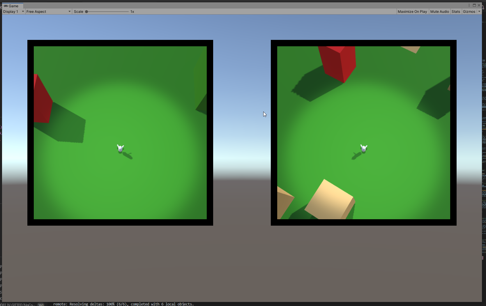
At least they sork properly with static icons – ones that are generated with the map and are never destroyed.

Each hud correctly displays only the icons that are in the vision range of the respective player and drops the icon when the object in question is visible on the minimap.

I think that will be all for the year.

Next – player inventory and item use, I think. We’ll see…

Squircle Resolved

At the end I had to give up on calculating my squircle by hand.

Two reasons

  1. Unity gives an automatic way to approach the problem;
  2. The tool Unity gives works with any (some kinds of any) type of shape, not only with geometrically correct squircles

I ended up using ray casting. I feel like I cheated, but.. that’s life. On one hand, I don’t have the nerve to develop the maths to deal with the problem myself, so… see reason 1. On the other hand, I have the consolation of working with shapes even better than a squircle.

Here’s how it goes:

You have a player somewhere on the map and a list of objects you want to track on your compass.

On the minimap you see the player himself. He always keeps his Noth-bound position, so when you rotate, you see the map rotating around you. Each trackable object (if not close to be seen on the minimap itself) is represented as an icon on the border of the minimap. The border is the ‘compass’.

You get the angle between the player forward position and the object in real world, then create an icon on the compass and place it on the compass, keeping the same angle between the up position of the canvas and the icon. The problem is the distance between the icon and the center of the minimap.

Here’s what you do – you have a secret object, outside of the playing area, that is basically a 3d version of the shape of your compass. That’s your ‘wall’. It’s hollow. In the middle there’s a radar object with a small script. You give that script the angle ‘in the real world’ between the player.forward and the object. The radar fires a ray at that angle and returns the distance to the wall at that angle.

You get that distance, scale it accordingly and give it to the compass.

If feels clunky to have a real world object that scans constantly to get the distance, but it undoubtedly works and it works with almost any shape, at that. The only limitation for the form of your compass and minimap is that the border can not swerve to an extend that one part of it blocks line of view from the center to another part.

Here’s the physical object with the (invisible) radar in the middle.

The radar is currently tracking 6 objects from the map, using angles, provided by the map itself. The visible rays are Debug.DrawRay().

Here are the map and the radar complex, set aside it:

You can clearly see that I haven’t even bothered to set the anchor points of the objects to the centers of their bases. I am tracking their basic 0,0 vertices here. Irrelevant.

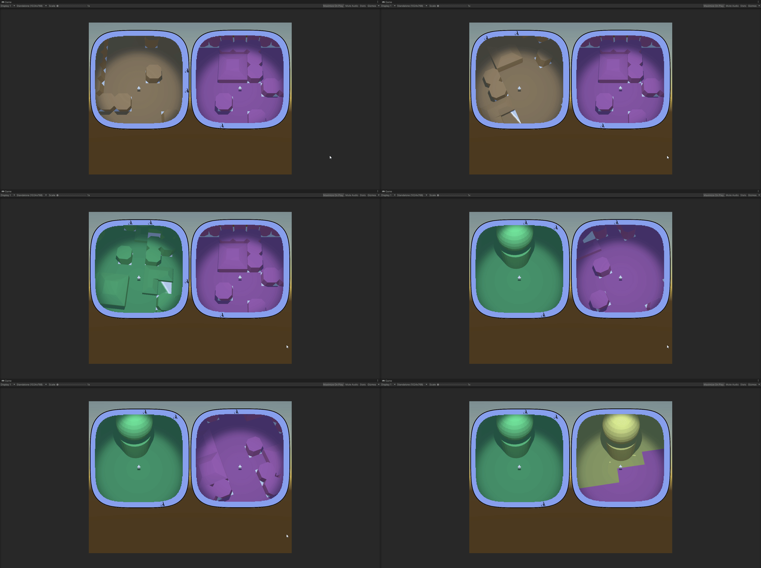
Here are both the scene view and the play view:

All colored objects are on the compass. The compass itself is the blue band around the minimap.

This was just a feature-dev scene, so I didn’t bother matching colors of objects to icons. Black icons are blue objects. Yellow is yellow.

So… this has not yet been transferred to the main scene. In the full version you have multiple type of objects that you can see on the compass, some only from a certain distance. All of them should disappear from the compass if there are actually seen in the minimap (here you can see the yellow object bot on the map and the compass).

This step of transferring the compass success to a ‘main scene’ type of actual structure will be hell…


Uuhh!! Look what I found ShareX can do!

Screen recording! And – Tadaaaa!  – Screen recording to GIF!

Biomes!

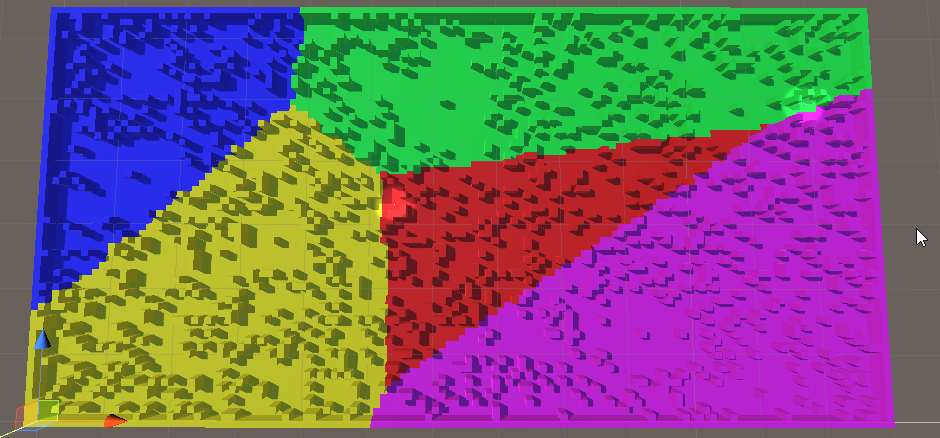
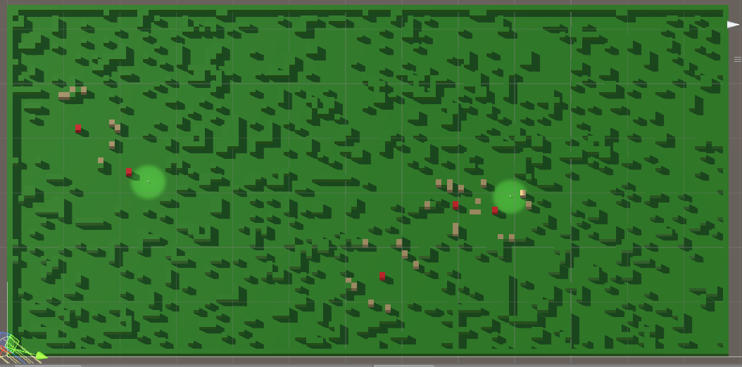
Aaand we have biomes!

In this case they have only a visual role. The objects that the environment is constructed of have types and those are what is functionally important. I need the biomes, however, to mark different sections of the map differently. The players needs to be able to look at their minimap and determine that they are not in the same type of terrain.

The approach I took was to select points on the map that are generally far away from each other, then flood the area around each one. Of course, steady flood would mean straight lines between the biomes, so I had to think of a randomness.

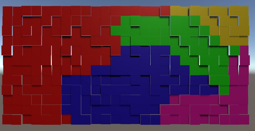
SomeBiomes

I used random ‘height’. There is no height in the game, but the concept for randomization is height and I needed a visual distinction between the tiles while devving, so…

The idea is that in each iteration of the flood a tile is evaluated.

Each non-marked neighbour is marked for checking (pretty standard).

The check of the tile itself is a comparison of the height of the tile against a pre-set threshold. If the tile is low enough – it is marked with the color of the biome. If not – it is lowered by an amount and added back to the collection of ‘to be checked’ tiles.

And if you do it for each biome in turn, each with its own flood – it works!

We’ll see how it will break when I add it to the main scene 🙂

Enter Squircle

So… Remember how the players use glorified minimaps to actually play?

One of the main features of the minimap is the compass – icons, showing direction to points of interest.

Easy enough to do it on a circular compass. Found a way to do it also on a square one. The main concern is that the circle does not cover space well and I would be happier if I can allow the players top see more of their surroundings. Here comes the square minimap. However, square is not… friendly. I kind of don’t like the sharp corners. This can be, of course, mitigated, by designing the whole UI to accept such corners, but why mitigate a problem when you can resolve it?

Enter squircle – a square with rounded corners. It would look well and give more visibility than a circle with same radius as it’s side length. But how do you project icons on the compass?

The way the compass works is simple – you get the angle between the player forward direction and the direction to the object, translate that angle on the minimap and place the icon the right amount away from the center of the minimap. Yeah, that’s the problem. For the circle it’s basically a non-problem. For a square – I found a solution online (see below).

But a squircle? I think I found the correct road to a solution, but it’s still a rocky road for a person how has not practice any meaningful math for decades.

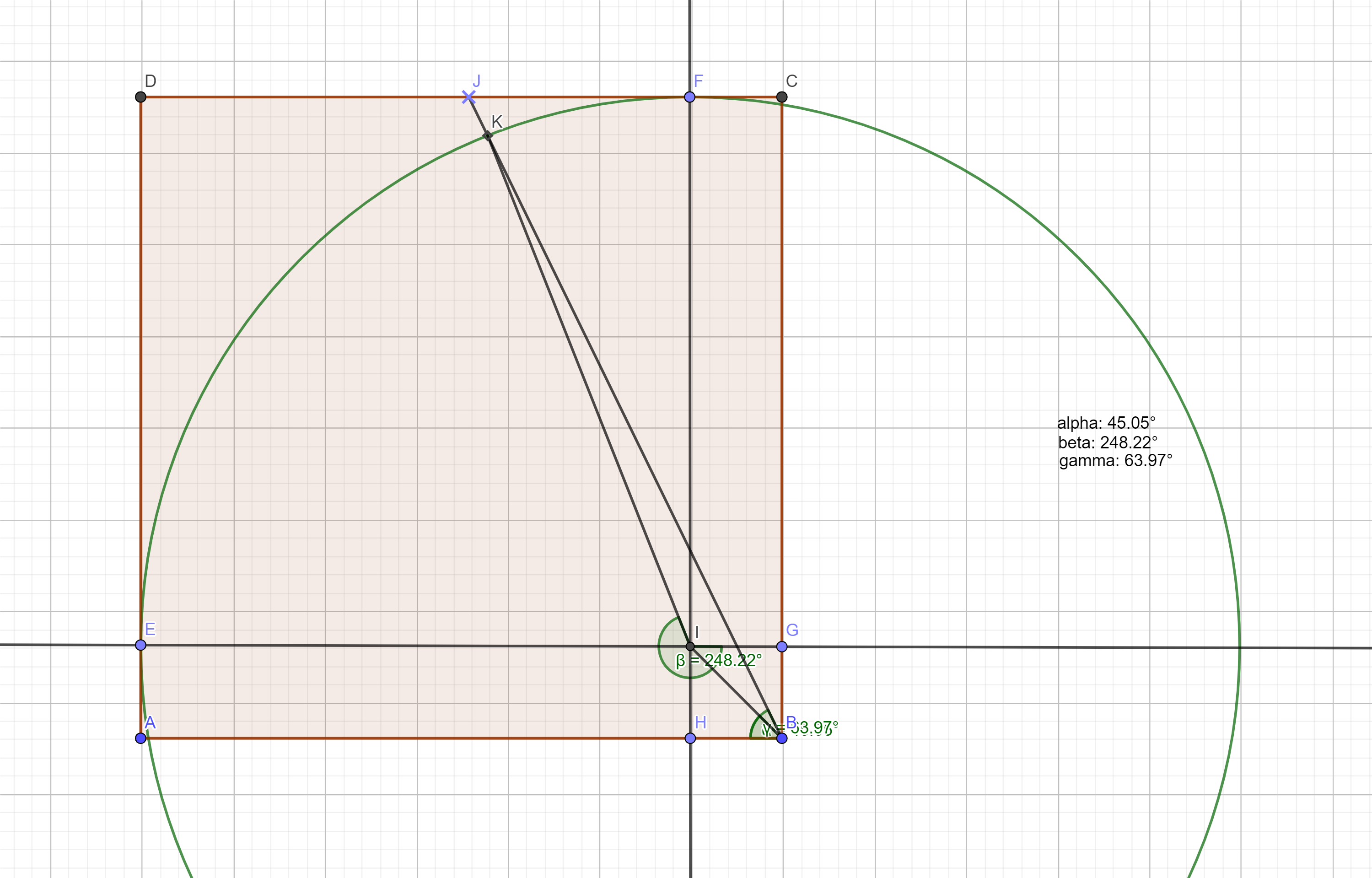
Here’s the construction:

a section of the squircle

The shape goes between two extremes. You have two governing variables – the radius of the corner circles and the length of the straight intervals between the corner circles. So the whole shape has two extremes:

  • it’s a circle if the intervals have length of 0
  • it’s a square if the radiuses are 0

What is given:

  • the radius of the circle
  • the length of the interval
  • the angle between (any) axis (IE) and the line passing through the center of the compass and the target icon (BJ)

What I need to find:

  • The angle between (any) axis (IE) and the line that connects the center of the circle and the crossection of the circle and the line from the center of the compass and the icon (IK)